11

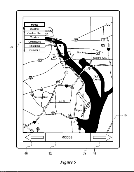
Apple recently filed for an "Interactive Map" patent that in every way resembles a collection of technologies and methods known as "Geographic Information Systems" (GIS). 10 minutes of your time can help narrow US patent applications before they become patents. Follow @askpatents on twitter to help.

Claim 1 in particular has been in active use by the GIS community for over 40 years:

A method for displaying a map on a computing device, comprising:

  • Storing information to be displayed on the map in a memory of the computing device, the stored information comprising a plurality of different layers of information, wherein each layer contains a respective type of information;

  • Displaying a map on a display of the computing device, the map comprising a plurality of the layers of information superimposed upon one another;

  • In response to a user selection of a display mode corresponding to a topic of interest, displaying at least one layer containing information that is associated with the selected mode; and

  • Enhancing the value of at least one display parameter for map features of each displayed layer that are associated with the selected mode, relative to a default value for the display parameter.

Likely innovators/publishers(manuals...)/patentees in this vein include Esri, Pitney Bowes and Google.

Please help find prior art from June 5th 2012 or earlier.

Prior art can be any publication (webpage, user manual, paper, book, youtube video, patent pre-grant publication) or patent. It is helpful to establish a date when the prior art was available to the public and a solid reference which can be cited by the USPTO. A citable reference can often be found in a contemporaneous publication about the technology in magazine, blog, or scientific article. Another place to look is The Wayback Machine.

Let's help inform the USPTO!

  • Publication Number: US 20130339891 A1
  • Priority Date: Seeking prior art predating Jun 5, 2012
  • Assignee: Apple, Inc.

Interactive Map US20130339891

What is good prior art? Please see our FAQ.

Want to help? Please vote or comment on submissions below. We welcome you to post your own request for prior art on other questionable US Patent Applications.

10
  • 1
    Prior art is not just issued patents. Each application is judged on novelty and non-obvious relative to every the ever public at any time. That means "is it possible that no patents surrounding this technology have been issued before?" is not the right question. Patented or not, has this method been described in a publication before?
    – George White
    Commented Dec 19, 2013 at 18:10
  • 3
    Thousands of publications. There are entire academic journals that focus on this. Commented Dec 19, 2013 at 18:34
  • I'm also curious how they plan to differentiate between what is "the map" and what are "different layers." A map without layers would be a ground without figure; no such map has ever existed
    – jscarto
    Commented Dec 19, 2013 at 20:35
  • 1
    This is a scary patent indeed. I see "method of suppressing" becoming more and more prominent across several patents. It appears that by excluding the obvious for various computing reasons, Apple and many others feel they can patent these methods. This would block all future innovation of any kind of GPS or mapping apps. GIS has been around since satellites were in space. Many, many, many applications have been developed which impose features on a map and suppress the outside information. Commented Dec 20, 2013 at 15:51
  • 1
    If you think about it, there goes all simulation products which use terrain based mapping data and impose navigation points, or even scenery models on top of a map. Commented Dec 20, 2013 at 15:52

15 Answers 15

12

I have been a GIS professional since 1969. I helped design and program two major GIS software packages. The first was a system called MOSS (Map Overlay and Statistical System). This fully interactive GIS package was deployed in 1978. MOSS had a command line interface that allowed the user to select map layers of interest (including attribute filters) and control the display of these layers at run time. MOSS was in the public domain and is recognized as the first open source GIS project. Therefore, all MOSS capabilities could be consider as prior art. I have copies of user manuals, design documents, and so forth. These documents are also in the public domain.

Carl Reed, PhD

3
  • I would imagine that just about covers it, though there's a cascade of additional examples between 1978 and 2012. Thanks! Commented Dec 20, 2013 at 15:22
  • 1
    This 1977 Publication by USGS would be an ideal summary of prior art including MOSS, but no electronic copies are available. Commented Dec 21, 2013 at 3:56
  • 1
    In 1986, Deltasystems released a commercial GIS called GenaMap. GenaMap supported real time rule based symbolization including scale rules, network analysis, real time attribute query, spatial views, and much more. In 1994, Genasys released the Spatial Web Broker. This application provided the ability to develop and deploy web applications that could access all GenaMap GIS functionality. I have put a call out to the old Genasys/Autometric community for users manuals. thefreelibrary.com/…
    – Carl Reed
    Commented Dec 26, 2013 at 17:12
5

1987, William Shatner narrates a video about GRASS GIS, a system released in 1982 that covers:

  • Claims 1-7
  • Claims 10-15
  • Claims 17-21
  • NOT claims 16 or 22
  • Claims 23-28
  • Claims 50-54
1
  • 1
    GRASS GIS, the first GIS
    – Jachym
    Commented Dec 21, 2013 at 22:06
4

Open Street Map Logo OpenStreetMap was founded in 2004: http://wiki.openstreetmap.org/wiki/History_of_OpenStreetMap

A 'plurality of the layers of information superimposed upon one another' is the normal display for this map. Information layers, such as highways, are defined through tags. Here's an example of the highway tag/layer and all the edits made to it since the year 2006 (click history to see each edit): http://wiki.openstreetmap.org/wiki/Highway

It has always been possible to highlight a particular element (line, point, or relationship) and see the entire edit history along with associated tags.

Open Cycle Map was created prior to 2009, highlighting a particular aspect of the OpenStreetMap layers: those of interest to cyclists. See the history tab at http://wiki.openstreetmap.org/wiki/OpenCycleMap for dates. The OpenCycleMap shows roads, but emphasizes roads for cyclists, and shows pubs, bike shops and ice cream shops more prominently than the main map.

4

I am the author of FlightMaster for PalmOS. It is a GPS mapping program for pilots, running PalmOS devices, and has been available since 2002. It is an example of prior art in the following ways:

  • Multiple layers of information, including airfields, various types of airspace etc, navigation aids and terrain.
  • Layers stored in multiple databases within the device.
  • Layers can be selectively hidden or displayed by the user.
  • Layers can be automatically hidden by the program under certain conditions (de-cluttering)
  • Allowing user to interact with the display directly to display further information about the selected item(s).

The user guide contained here is the latest version, and illustrates the concepts above. It is the latest release, dated from October 2010, but I have version-controlled copies going back further:

http://palmos.flight-master.com/downloads/FlightMaster.zip

Page 33 shows the configuration dialog for the various layers.

2

US Patent 4,428,057 from 1984, "Electronic Chart System"

"An electronic chart system in which charts of the earth are stored in digital representation and communicated to the operator by a visual display. Through the use of a Loran-C receiver or the like, the system additionally plots the carrier's position on the visual representation of the chart."

1

I would like to introduce as Prior Art:

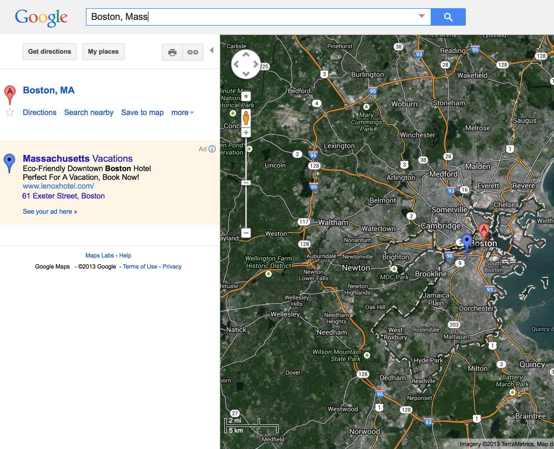
Google Maps

http://maps.google.com

Google Maps

3
  • 1
    It is helpful to establish a date when the prior art was available to the public and a reference which can be cited by the USPTO. The USPTO Examiner can try to track this down himself or herself but it is easier for the office to use the prior art on Ask Patents if we provide a solid reference, ideally with an element-by-element comparison with the subject claim. A citable reference can often be found in a contemporaneous article about the technology in magazine, blog, or scientific publication. Another place to look is The Wayback Machine. Commented Dec 20, 2013 at 18:19
  • 1
    This is a good submission. Thank you. However, you likely got this just now? We must have prior art from before June 5th 2012. Preferably, one prior art reference (like a screenshot or video or whatever) will show EACH element of the claims. A short comment drawing your analogies would be very helpful to the Examiner IMHO. E.g. Satelite layer, roads layer, city outline, ... :) Commented Dec 20, 2013 at 18:58
  • 1
    I agree, it was a knee-jerk reaction to the obvious. I was only hoping to provide a clue. Vote me down! Commented Dec 20, 2013 at 19:00
1

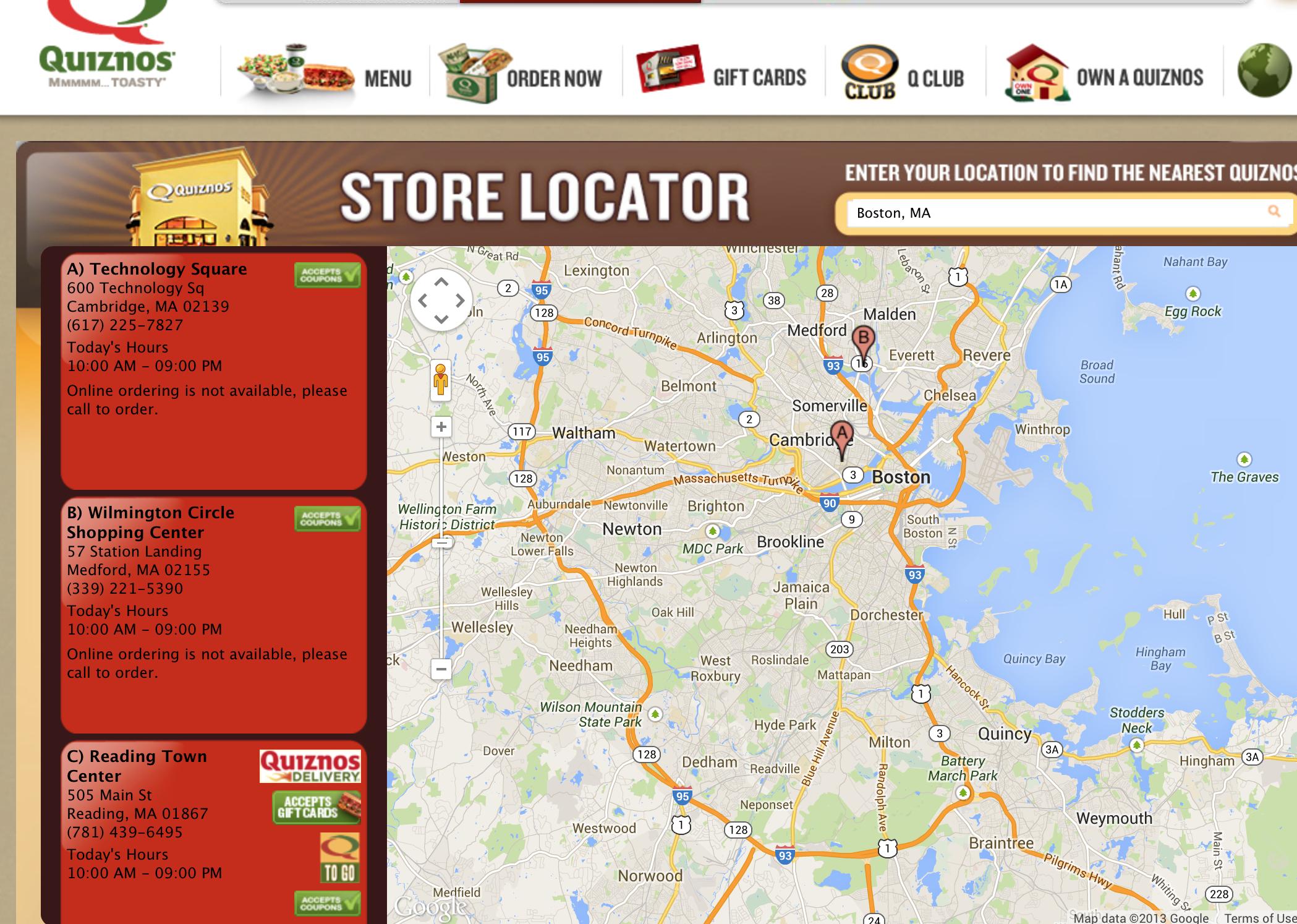
Quiznos Store Locator

Locates a store with selectable map modes. Common across thousands of websites, in-app maps, and more. Excludes (method of suppressing) outside map data based on the person's location (search criteria) which can be geo-targeted through javascript.

http://www.quiznos.com/storeLocator.html

Quiznos Store Locator

3
  • 1
    It is helpful to establish a date when the prior art was available to the public and a reference which can be cited by the USPTO. The USPTO Examiner can try to track this down himself or herself but it is easier for the office to use the prior art on Ask Patents if we provide a solid reference, ideally with an element-by-element comparison with the subject claim. A citable reference can often be found in a contemporaneous article about the technology in magazine, blog, or scientific publication. Another place to look is The Wayback Machine. Commented Dec 20, 2013 at 18:21
  • Sorry for the quick obvious. The application was Dec '13 which is why right now, it covers everything in relation to mapping. I'll do a more detailed analysis with some older examples. I'm sure we can also cover radar maps as well. Commented Dec 20, 2013 at 19:01
  • The priority date for the application is June 5,2012. That is the date before which prior art must have been published or offered for sale. Commented Dec 21, 2013 at 0:47
1

Here are some links to official, dated, press releases that reference interactive maps that were developed, released, and publically available prior to June 5, 2012. Feel free to use any of these.

http://www.oregongeology.org/pubs/nr/press-release-2012-02-23.pdf http://www.oregongeology.org/pubs/nr/press-release-2012-01-31.pdf http://www.oregongeology.org/pubs/nr/press-release-2011-01-19.pdf http://www.oregongeology.org/sub/news%26events/archives/press-release-2009-05-28.pdf http://www.oregongeology.org/sub/news%26events/archives/press-release-2008-07-18.pdf

1

Here's one of our prior patents that might help.

http://www.faqs.org/patents/app/20110010674

Also remember, a pencil and an eraser can each be patented, but so can a pencil with an eraser.

1

Roger Tomlinson, who died 4 days ago, is known as the "Father of GIS".

He initially defined the art over 50 years ago.

http://www.gislounge.com/phrase-geographic-information-systems/ http://www.esri.com/news/arcnews/fall12articles/the-fiftieth-anniversary-of-gis.html

0

http://geochico.csuchico.edu/bcep/

I don't know if this helps, but it is a link to a flex webmap I built in 2010-11 for a graduate school project. The date is clearly listed on the splash screen.

Is this the kind of submission they are looking for (but maybe more of a screen shot with text highlighting what parts match the patent application)?

2
  • This is a good start. The patent Examiner needs to be able to cite the public disclosure in the "Non-Patent Literature". The citation should ideally include a date stamp (to show that the prior art was public at some time prior to the priority date of the application). One place to look is The Wayback Machine. Yes, it is better to show screen shots with text indicating the connection between each element of the claim and an element in your prior art. Good prior art would could contain many or all of the elements in the claim. Commented Dec 23, 2013 at 22:38
  • I never thought I would see the day when Flex would prove useful for some purpose. Commented Dec 23, 2013 at 23:58
0

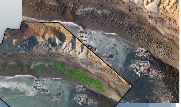
This is my mapping program that is done with our proprietary software. I call it SEED. enter image description here

We put the data in layers and define the information about the layers of data. We collect the information, analyze it and distribute it through the web and smart phones etc. This is one mosaic from last year. The data is put together with other real time data.

1
  • This is a good start, Brian. The patent Examiner needs to be able to cite a public disclosure in the "Non-Patent Literature" section of his or her docs. The citation should ideally include a date stamp (to show that the prior art was public at some time prior to the priority date of the application). One place to look is The Wayback Machine. Good prior art would contain many or all of the elements in the claim, so whatever you can show to draw that comparison directly would be helpful. Commented Jan 9, 2014 at 22:19
0

How about an existing patent from 1996 for online maps:

http://www.google.com/patents/US6240360

Here is another one that might be relevant:

https://www.google.com/patents/US20080162407?dq=ininventor:%22Sean+Phelan%22&hl=en&sa=X&ei=2D0YVL2gBILX7AbIzICYBw&ved=0CCYQ6AEwAQ

0

http://web.archive.org/web/19970401002943/http://www.algonet.se/~jason/enter link description here

A interactive map is a image. So technically this webpage of mine from 1996 is prior art for any image on internet and computer device that is interactive.

If not then it is possible to patent any image that is interactive and is not already published.

The word should be, Interactive Images?.

http://web.archive.org/web/19970401002943/http://www.algonet.se/~jason/#Itsme/

0

It appears that ESRI, the maker of ARCGIS software, has been in business since 1969:

http://www.esri.com/about-esri#who-we-are

I am not able to recommend this software, but it does use layers and allows suppression. As such it appears to constitute prior art.

You must log in to answer this question.

Not the answer you're looking for? Browse other questions tagged .